I travel to Germany to visit family approximately once every 18 months. This year, I mixed things up a little bit and asked my mother and my sister to meet me in Spain for a hiking vacation. We ended up spending five days in Vall de Boí, a dead end mountain valley in the Pyrenees. One valley to the west is the border between Catalonia and Aragon, 50 miles to the north is the border to France.
Regular readers of this blog should know that I have no plans to become a travel blogger1. This post exists because with Vall de Boí I feel like I was lucky to discover an excellent travel destination about which only sparse amounts of information exist for anyone who is not fluent in Spanish or Catalan. The target audience of this report is people Google sent here after searching for “Vall de Boí” as well as anyone looking for a place to go hiking that Lonely Planet doesn’t know about (yet).
How I found out about Vall de Boí was dumb luck: Seeing that there are direct flights from Oakland to Barcelona, I explored green patches on Google Maps within a reasonable driving distance of Barcelona. A serendipitous half hour later I had my mind set on Vall de Boí. If I remember correctly, the first place I read about it was a two-star review for a ski resort elsewhere in the Pyrenees that mentioned Vall de Boí as the better alternative.
Vall de Boí
To get your bearings of the valley on a map, find the L-500 road. It branches off of N-230 just north of the town of El Pont de Suert and ends 24.3 kilometers to the north and 925 meters of elevation higher on top of the buttress dam of the Pantà de Cavallers reservoir. The road mostly follows the river La Noguera de Tor. Driving (or cycling?) up the valley, you pass a few villages. Most notably, Barruera has the only campground of the valley and a few stores and Boí after which the valley is named and which is the tourism center of the valley. Boí is off the main road on L-501 which ultimately gets you to the Boí-Taüll ski resort. Once you pass the spa and resort Caldes de Boí, the road becomes single lane for the remainder of the way up to the dam.
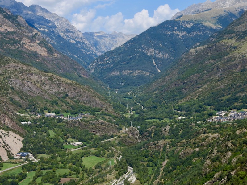
Erill la Vall to the left and Boí to the right
The terrain is very steep: The base elevation of the valley is 1200 meters in Boí, the plateau in the National Park is at 1700 meters, and several of the nearby peaks exceed 3000 meters. Keep the effects of this terrain in mind when planning hikes: Weather is regional and varies valley by valley, south facing slopes are hot and rocky while north-facing slopes are covered in vegetation, and it gets dark early in the valley.
Outside of ski season, there seem to be two main reasons why tourists come to Vall de Boí. First, the Romanesque churches of which each of the 11 villages in the valley has one and which earned the valley the listing as UNESCO World Heritage site. And second, the national park with the really hard to spell name to which the northern end of the valley provides access routes2.
We stayed in the La Plaça Hotel in the village of Erill la Vall, directly across the tiny village plaza from the Santa Eulalia church and the visitor center that has information about all churches in the valley. While we didn’t come to Vall de Boí with a particular interest in the churches, seeing them during our hikes made me wonder what life in this region was like 800 years ago when riches from silver mining allowed the locals to invest so many resources into cultural and artistic activities. One thing to be aware of when planning to visit Vall de Boí to see the churches is that most of the artwork from the churches are kept in the MNAC in Barcelona.

Erill la Vall seen from the church tower of Eglesia Santa Eulalia
While researching Vall de Boí I didn’t find any terribly useful online resources beyond the common ones:
- Wikipedia has the basics on geography and history, as usual. There is a separate article about the churches.
- The tourism agency website has listings of hotels, restaurants, and activities, but fails to give a good overview for first-time visitors.
- The reviews, photos, street view, and satellite imagery features of Google Maps are quite detailed and complete for this region (often auto-translated). You won’t find the menu for every restaurant on there like you would in San Francisco, but there are opening hours and street view images for most, unlike in Germany.
Maps and Literature
Like I mention above, I decided to write this blog post in part because there are only a few English language resources available about Vall de Boí and the Aigüestortes i Estany de Sant Maurici National Park. For maps and guidebooks, you will have to resort to Spanish or Catalan language ones. I ordered the following two:
The 1:25,000 Trekking Map by Editorial Alpina (ISBN 9788480906951, Amazon.com link) contains two separate maps for approximately each half of the National Park, one half also containing all of Vall de Boí. Note that there is a 2017/2018 edition of this map but some websites and product listings still reference older editions, and not a single website shows the correct cover image for the 2017/2018 edition. This is the most detailed map (seemingly most comprehensive for hiking paths, terrain lines spaced 10m) I could find that was available from a US-based vendor (shipping times from European map and bookshops are often several weeks). The legend is quattro-lingual: Catalan, Spanish, French, English. This was our main map on the trail and it only led us astray once: The path between the National Parking lot and Boí is shown in the map does not exist, but fenced off approaches at either end suggest that it once did. Unfortunately, the paper quality is poor, mine had several tears and stains after four days of use on the trail, so maybe order two.
The hiking guidebook by Sua Edizioak (ISBN 8482165704, Amazon.com link) is a small pamphlet with short descriptions of 10 hikes and 12 ascents as well as a 1:25,000 double-sided map. The map is printed on even lower quality paper than the Editorial Alpina one and has significantly less detail: Fewer landmarks, far fewer trails, and weirdly large 3D icons. Four of the hikes are accessible from Vall de Boí (the others are on the other side of the National Park) and several of the ascents are, too. I had the Spanish language version, there’s also a French edition (ISBN 8482166018). Since I would rely on neither my Spanish nor my French skills to navigate me through the mountains I took photos of each page with the Google Translate app and read the auto-translation. My main problem with the guide is that most of the suggested routes have one-way estimates of more than 5 hours and even those are aggressive. What’s noteworthy is that the GPS tracks of all routes are available on the book website.
I only found out about Editorial Alpina’s hiking guide book after the trip. It’s Spanish language and currently not available from US-based vendors, but the routes listed in the product description seem much more achievable for casual hikers than the ones in the Sua Edizioak book.
If you are looking for a last-minute map purchase: I saw a small selection of maps, including the Alpina map mentioned above, for sale in a store in Barruera. The tourist information and other stores probably have maps too.
Open Street Map (OSM) has very good coverage of the area too. At maximal zoom levels, it exceeds both printed maps and Google Maps in terms of feature details. For hiking trecks, it is a mixed bag: Open Street Map does not include the false positive mentioned for the Alpina printed map above, but it’s also missing two smaller signposted we hiked on. Keep in mind that there is no wireless signal in the National Park, so make sure to download relevant map sections if you plan to use them during your hike!
Language
First things first: Vall de Boí is in Catalonia, an “autonomous community” in Spain whose independence movement has recently been in the news. The Catalan language is the primary language spoken among Catalans and is also the language of instruction in public schools in Catalonia. Virtually everyone in Catalonia also speaks Castilian, the language also commonly known as Spanish and readily switches between them.
Compared to my fellow Europeans, my foreign language skills are limited, I only speak English and German conversationally. What made this trip almost a little too pleasant is that almost all other tourists we met spoke Catalan (trail greeting: “hola, bon dia!”) or Spanish (trail greeting: “hola, buenos días!”) among themselves3, but everyone and everything was prepared to accommodate visitors who don’t speak the local languages.
Every restaurant we visited has a bilingual English-Catalan menu in addition to the default Catalan-Spanish menu. This setup works even when your waiter doesn’t speak a word of English: You point at the English menu entry and they read the Catalan translation to figure out what you want. Most restaurant and hotel staff knew at least a little English and seemed quite excited to practice it. For example, the waiter who was regularly pulling 14-hour shifts in our hotel’s restaurant learned “ham” as a new word from our packed lunch order (we’ll have to work on the pronunciation of the leading “h” next time we visit).
My attempt to learn a few words of Catalan before the trip earned me a few blank stares. Catalans don’t seem to take offense when you attempt, poorly, to say a few words in their language, but they seem rather confused when you then can’t fall back to Spanish.
Park Nacional
There are many great hikes in the valley and the surrounding mountains, but you’d be missing out if you go to Vall de Boí and don’t go up into the mountains of the Aigüestortes i Estany de Sant Maurici National Park. According to Wikipedia, the park name means “The winding streams and St. Maurice lake”. Not sure why the winding streams made the but the hundreds of other lakes besides St. Maurice did not.
The park is sized such that crossing it on foot (the only legal mode of transport) takes the ambitious hiker two days. Several long-distance trails cross the park in all directions, for example, the GR-11 “Transpirenaica”. We were only up for day hikes, but multi-day hikes would overnight at one of the nine “refugios”, mountain huts that are operated and catered during the summer. The Carros de Foc is a route that passes all nine of them, and its website is a good place to find links to the website of each of the independently operated refugios.
For day hikes, starting the hike from the edge of the park would limit the routes a lot. Luckily, there is a “taxi” service that drops you off at the “Planell de Sant Esperit” plateau several kilometers inside the park at 1800 meters. From there, the interior of the park with the many lakes is within reach for day hikers. I wasn’t able to figure out how these “taxis” work ahead of time (FYI: the taxi service’s Flash website, last updated in 2005, is outdated). Here’s the deal: Park your car at the free public Parking Lot near the church in Boí, then walk up the stairs past the church to a little square just off the main road. You’ll see parking spots reserved for taxis, maps of the park, and an office where you can buy taxi tickets. The taxis are white eight-seater minivans and there’s almost always one waiting both here and at the drop-off location in the park. As soon as all the seats are filled, the taxi leaves. If the seats don’t fill up, they guarantee a maximum wait time of 20 minutes before they leave even with open seats. Hold on to your ticket, the driver will collect it at the end. Round trip tickets are 5.50 Euros, one-way is 4.00. The ride takes approximately 25 minutes which mostly consist of the driver racing up a single lane paved but bumpy mountain road, occasionally hitting the breaks for taxis going the other way or cows.
Did I mention the cows? Commercial activity is not allowed in the National Park with two exceptions: Hydropower generation and cattle ranching. There are hundreds of off-white cows walking around seemingly freely in the park. They wear huge cowbells and are friendly. I’m sure there is an interesting story in the why and how of this, but I haven’t found it yet.
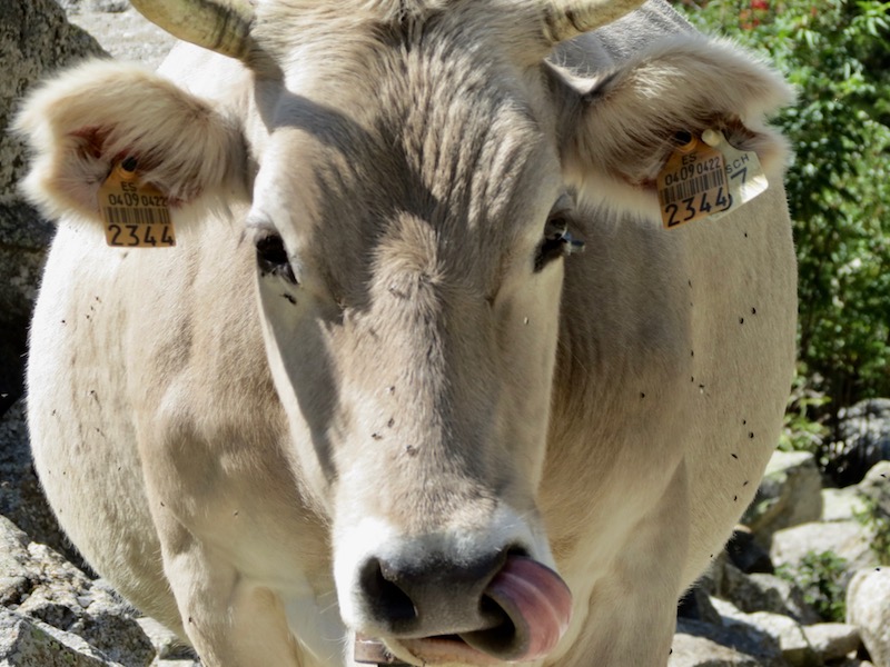
A cow in the Aigüestortes i Estany de Sant Maurici National Park
The National Park’s official website has some information in a mix of languages, and a great Instagram account.
Food
The cuisine is rarely a reason to visit a mountain valley, but in Vall de Boí it might as well be. Our food choices were mostly practical, yet we ate some very delicious food at very reasonable prices. If you’re hungry and don’t want to do your own research, try out these restaurants:
- Pizzaria Casós in Boí is no fine dining but no Dominos either: It’s a bar and casual sit-down restaurant that happens to mostly have pizza on the menu. The pizza is on a soft pastry-esque base that probably isn’t to everyone’s liking but I dig it. Pizza Muntaña style with bacon and meat topped with an egg is the house specialty and I say you should try it.
- Restaurant El Calíu in Taüll was our fine dining night out. It’s the kind of place where you don’t need to wear a shirt, but you might as well. While you’re in Catalonia you should try Escalivada, might as well do it here and have it topped with tuna and anchovies (on the “cold starters” menu).
- Restaurant La Granja inside Hotel Casa Ferro is where we went back on our final evening because the food was just too good. Eat anything from the main menu, but don’t miss the cheesecake made with “just a bit” of blue cheese!
Pizzaria aside, all restaurants had Table d’hôte style menus in a format I had not seen before. Many had two three-course fixed price menus with two or three options for each course. However, they would allow dropping any of the courses and mixing the two menus, effectively giving you the same options as an à la carte menu. And since that’s not confusing enough, there would usually be an additional page with à la carte options. The bottom line is: Order whatever you want.
Don’t arrive too early though! In Spain, dinner time starts at 8.30pm. The restaurants we visited were slow paced and only did one seating per evening. We usually arrived around 9pm and left around 11pm.
Weather Forecast
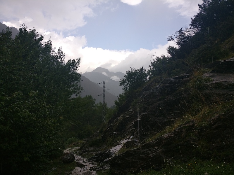
Mountain weather is no joke. In September, when we visited, afternoon thunderstorms are common on this side of the Pyrenees and we did indeed get our fair share of thunder and torrential downpours.
This might be obvious to other European hikers, but I only learned on this trip that Meteoblue is the best weather forecast for Europe4. Especially when you care about rainfall around a location, their rainSPOT visualization is genius. The geo-nerd in me rejoices about the multimodel view that shows the forecast from 15 different weather models next to each other. They have the best forecasting model and the most detailed presentation of the forecast. I found out about it through the recommendation of our hotel’s front desk.
In summary: Get the Meteoblue app or bookmark the website and check the forecast before heading into the mountains. And take rain gear: waterproof jacket, pants, backpack cover, and you have waterproof shoes anyway, right?
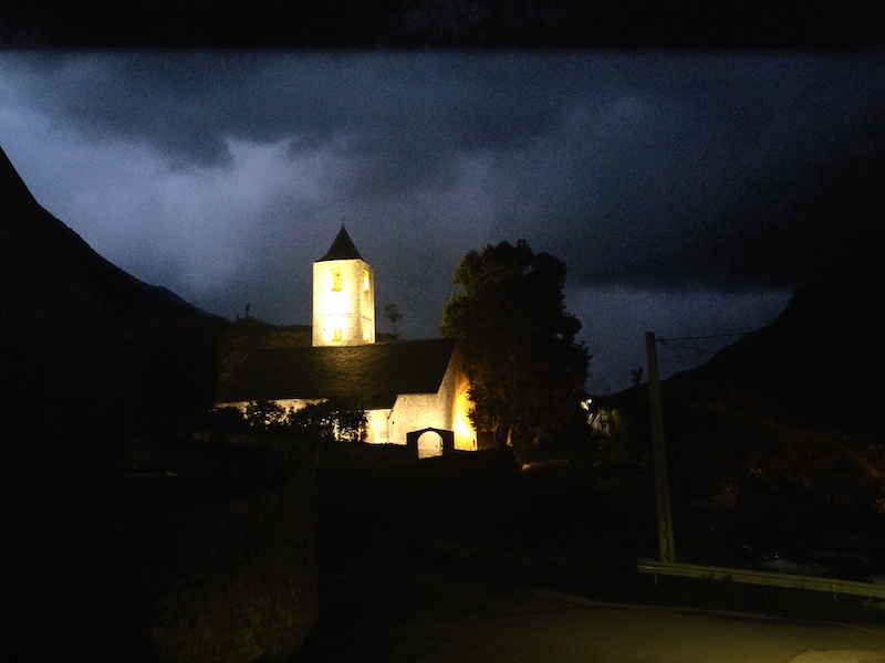
Sant Joan de Boí at night with lightning in the background
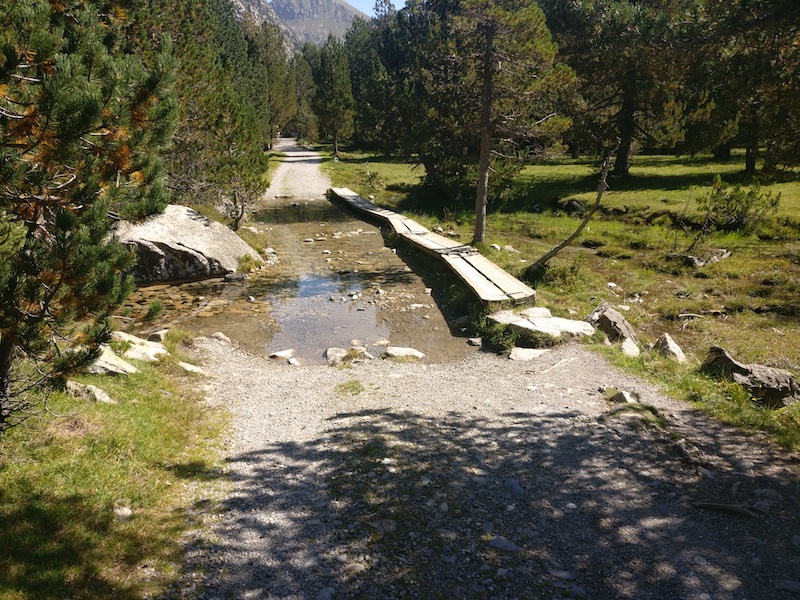
Warmup Hike: Camins Vius Loop (2 hours)
After driving to Vall de Boí from Barcelona we arrived around lunchtime and decided to head out for a quick hike to stretch our legs. The Camins Vius long distance trail passed our hotel and split into two possible routes up the mountain behind our village. We immediately learned the first lesson of hiking in a steep valley: What looks like a small loop on the map, can be a strenuous long hike up and down a steep slope. The views were spectacular nonetheless.
Park in the parking lot at the far end of Erill la Vall. Follow the signs for “Camins Vius” to head up the mountain following the Barranc d’Erill stream. When the trail splits into one branch heading north towards a dam and another heading south into the forest, cross the water and head into the forest. It’s hard to get lost here and occasionally posts provide reassurance. Once you meet the other branch of the Camins Vius, turn to head back down into the village.
Boí and Taüll seen from a lookout along Camins Vius
Hike 1: Estany Llong and Estany Dellui (6 hours)
For our first full day of hiking, we used the taxi service into the National Park. From the taxi drop-off location we followed the well maintained and signposted gravel track to the Refugi Estany Llong.
Main path to Estany Llong in the Aigüestortes i Estany de Sant Maurici National Park
After lunch break overlooking the lake we decided that following the same track further would be just too boring. Instead we started climbing a footpath towards “Estany Dellui” starting almost exactly where the main track passes the refugio. This path is also signposted (sometimes as “Carros de Foc”) and well maintained, but distinctly steeper. An hour later, we were still climbing and questioning our choices.
After 90 minutes of gaining height the path bent around a mountain into a smaller valley and the view opened over “Estanyets de Dellui” (“estanyets” being little lakes). Neither the dark clouds nor the boulder field ahead of us helped our mood but we soldiered on and reached Estany Dellui, the big brother of the estanyets, just when the thunderstorm reached us. The forecast was on showers, and the downpour did indeed only last for 10 minutes, followed by a bit of hail and then sunshine. Don’t loop around Estany Dellui, instead turn left just before you reach the lake to head back down into the valley. This part of the path is less obvious and not in every map but yellow posts guide the way, once again passing the Estanyets. If you don’t mind missing out on seeing Estany Dellui, you can skip the aforementioned boulder field and turn right to and cut through between the Estanyets de Dellui to meet the path that gets you back into the valley, saving about 30 minutes.
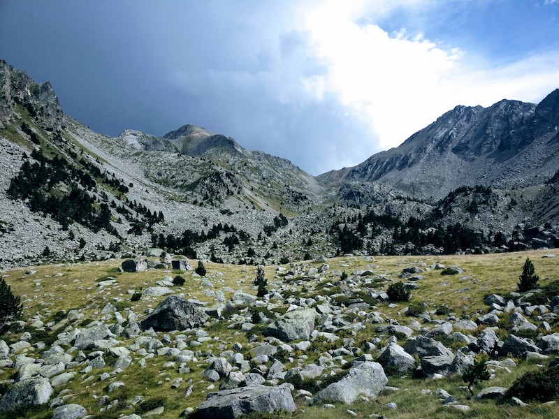
The valley of Estany Dellui in the Aigüestortes i Estany de Sant Maurici National Park
The steep descent back to the main track between the taxi drop-off location and Estany Llong follows the unnamed little stream that drains Estany Dellui. Soon you’ll hear the bells of the cows down below and be grateful that you didn’t do the detour towards Estany Dellui in the other direction because, wow is this steep. Maybe stick your feet into the water once you reach the bridge across Riu de Sant Nicolau?
Just as we got back to the taxi location, heavy rain started that wouldn’t stop for several hours. Overall we spent six hours hiking that day. The time estimates given on signs along the way were correct for our pace that involved a fair amount of huffing and puffing and pausing “to enjoy the view”.
Hike 2: Four Villages Loop (4 hours)
After our adventure in the mountains on the first day, we decided to stay in the valley for day 2. Starting from the same parking lot in Erill la Vall as in the “warmup hike”, we followed the signs towards Barruera. The path passes through gardens before crossing the L-500 road through a tunnel and then follows a mountain bike route all the way to Barruera, taking an hour or so.
My sister wasn’t particularly pleased when she found out that my secret plan had always been to not simply return on the other side of the river, but to climb 250 meters up to the village of Durro and follow a path higher up to get back. My mother cast the deciding vote and off we were, climbing the hiking route “Cami de Durro a Barruera” which starts at the road to Durro 200 meters after the bridge in Barruera. This is a north facing slope, so you’re in the shade of trees most of the way with some beautiful moss covered old stone walls separating the path from field.
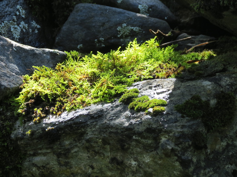
Moss covered stone wall along trail from Barruera to Durro
It’s easy to get lost in Durro, so we did just that. After looking at the map one more time we found the start to the path to Boí by following a concrete wall around a private property. The view gets better once that is passed. My kudos to to anyone who actually rides this path on a bike, as suggested by the signs. From Boí we walked another half hour back to our hotel in Erill la Vall on the other side of the valley, this time crossing the road without the help of a tunnel.
Four hours later we had seen four of the villages in Vall de Boí: Erill la Vall, Barruera, Durro, and Boí.
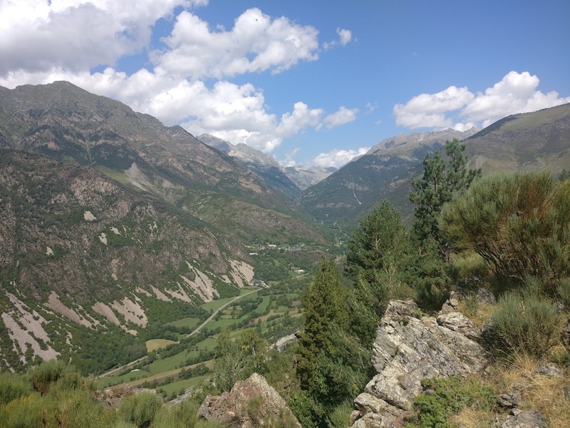
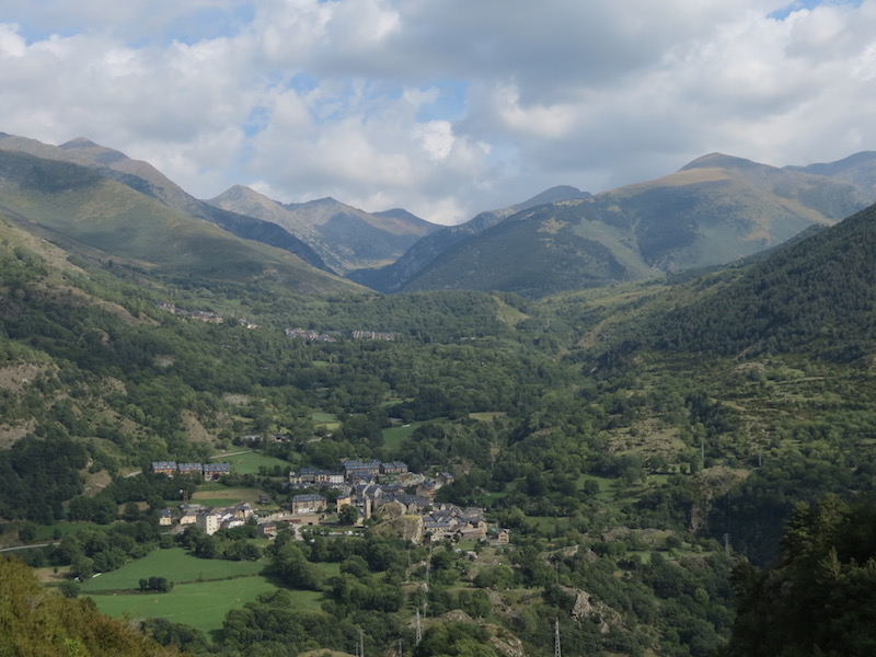
View over Vall de Boí from the path between Durro and Boí
Tourism is very clearly the main economic activity in Vall de Boí. Most buildings along the main roads are hotels or vacation rentals or restaurants. But, of course, there are locals and they do the same sort of things that locals everywhere do, such as forming a band. “Crystal Durro” had posters up all over the valley:
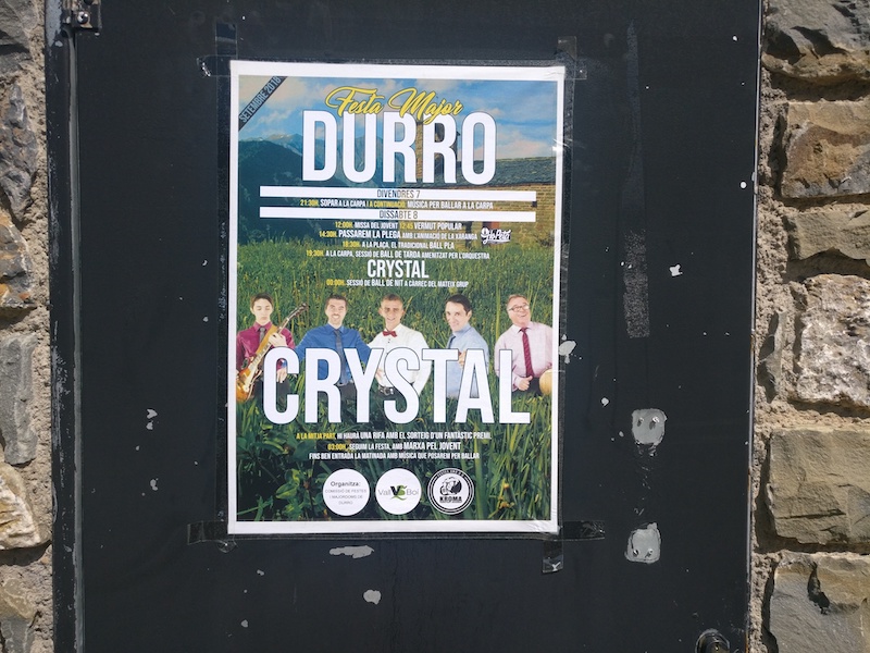
Poster advertising Crystal Durro
Hike 3: Cavallers Reservoir (2 hours)
The weather forecast was for rain in the afternoon. And maybe we aren’t as avid a bunch of hikers as we thought. Maybe we can find a flat route in the mountains?
On our third day we drove up to the dead end of the valley at the topmost parking lot right by the Cavallers reservoir dam. This one probably fills up on busy days, but there is plenty of overflow parking one switchback below.
It’s only a quick but steep 5 minute climb to the top of the dam. While we just got started, the trio of cyclists we met on the dam had just completed the ride from El Pont de Suert.
The path along the eastern side of the reservoir is only flat on average, but a constant up and down over and around rocks of all sizes. It was also the busiest of all routes we hiked and we passed or were passed by or let pass someone every other minute or so. Once you reach the far end of the reservoir lake, you could start the climb to 3029 meters high Pic de Comaloforno to the west or follow route 15 from the Sua Edizioak book mentioned above to Estany Negre, the Black Lake. We did neither and turned around to get back to the car for a total hiking time of under two hours.
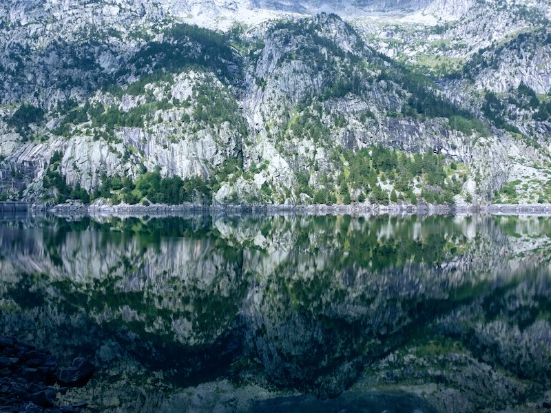
The Cavallers reservoir lake
Driving back down the valley we parked in the parking lot at Caldes de Boí, ate lunch at the well by the road saying hello to the construction workers who stopped to fill up their water bottles before siesta. From there we followed the path west of the river back upstream, then crossing the road bridge to get to Campament de Toirigo (a youth camp). Turn right just before the first buildings of the camp and follow the forrest track up the mountain which ends at an overlook on top of old building foundations. There’s no reason to recommend this hike, but I got a few macro photos of flowers out of it and it kept us busy until the scheduled arrival of the rain.
Hike 4: Descent from National Park (3 hours)
For our final day of hiking we aimed for maximal laziness. We bought a one-way taxi ticket to go from Boí into the National Park and immediately started the hike back down. Everyone else seemed to be sweating their way uphill while we had a relaxed downhill stroll. Based on a park ranger’s recommendation we took aslight detour past the small chapel of Sant Nicolau. Otherwise, the path took us past Estany de Llebreta which we had already seen from the taxi rides, cow pastures, and lots of flowers.
Hiking in the rain near the village Boí
For the last hour of hiking in this vacation we got very lost and very wet. From the main parking lot at the entrance to the park, you have to follow the main road back to Boí. Unless you believe the Editorial Alpina map which has an unpaved track parallel to the road most of the way. The track exists but it fizzles out into a maze of cattle paths just when the rain really starts. We ultimately turned around and followed the road until just before the intersection of L-500 and L-501. The hiking path from here into Boí does, in fact, exist and leads you straight to Pizzaria Casós in Boí. We walked the final 100 meters back to our car in hail. The car park had turned into an ankle deep lake.
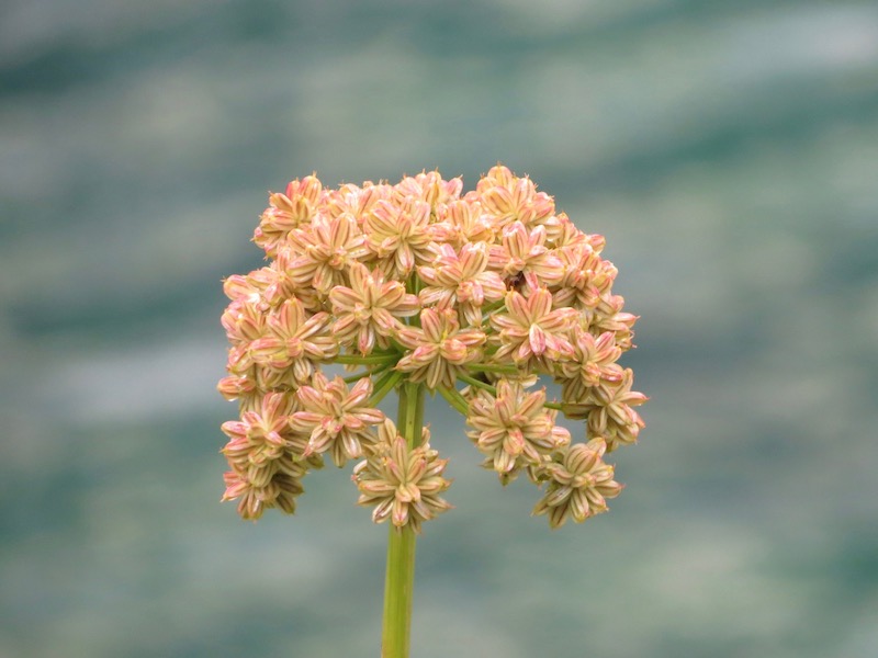
Macro flower
Footnotes
I leave that experiment up to my significant other whose recent three-piece series about our 2016 Iceland trip you should read! ↩︎
The other place to access the national park is from the town of Espot, two hours of driving or two days of hiking to the east of Vall de Boí. ↩︎
During our week in Vall de Boí I only encountered a handful of (British) English speaking tourists. Germans tourists, who seem to be present at every other tourist destination worldwide, were a true rarity in Vall de Boí: A park ranger was puzzled by the fact that he had run into another 10 Germans even before he met us that day! ↩︎
The reason for my ignorance about Meteoblue is probably that they only started operating as a company one year before I moved to America. The Wikipedia page about the company is an interesting short read. ↩︎